For drone pilots
Stop tracing lot lines by hand.
Built with extensive input from drone pilots, photographers, and real estate developers. Boundray handles the part of the job that eats your evening: getting accurate property lines onto every photo and turning a folder of JPGs into something a client can actually present.
What changes
The evening work goes away. The output gets better.
Export 40 frames, open Photoshop, trace lines by eye on each one.
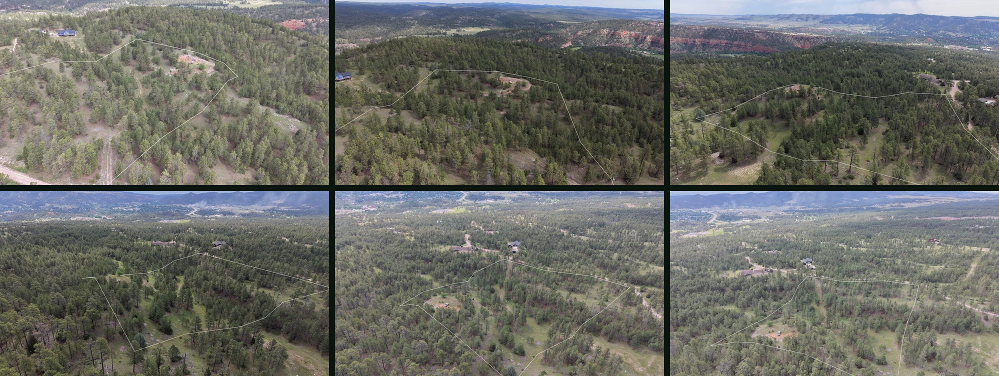
Pick the parcel once. The boundary projects onto all 40 using camera pose and terrain.
Guess where the property line falls behind a treeline.
Lot lines are projected onto your photo, making for quick and easy refinement, with a side by side 3D map view so you can make sure they line up with reality.
Batch edits in Lightroom, then re-check every sky.
Zoned auto-enhance treats ground and sky separately, with ML sky segmentation.
Email a Dropbox folder and hope the agent uses the right files.
One share link and an embed snippet. The client account is free.
A shoot, start to finish
- 01
Create the project and upload the photos from your flight. GPS, altitude, gimbal, and flight yaw are read per frame.
- 02
Pick the lot from county GIS, or import a KML/KMZ from the surveyor.
- 03
Run batch enhance across the shoot: split ground and sky, or straight auto.
- 04
Review each frame; nudge, warp, or trace the boundary where cover is heavy.
- 05
Add labels: acreage, corners, easements, access, features.
- 06
Publish. Send the link, hand over the embed code, or invite the client to their free account.